WoRMS taxon details
Ramisyllis multicaudata Glasby, Schroeder & Aguado, 2012
596208 (urn:lsid:marinespecies.org:taxname:596208)
accepted
Species
marine, brackish, fresh, terrestrial
recent only
Glasby, Christopher J.; Schroeder, Paul C.; Aguado, Maria Teresa. 2012. Branching out: a remarkable new branching syllid (Annelida) living in a Petrosia sponge (Porifera: Demospongiae). Zoological Journal of the Linnean Society 164(3): 481-497.
page(s): 483 [details]
page(s): 483 [details]
Holotype NTM W23745, geounit Darwin Harbour
, Note Channel Island, Darwin Harbour, Australia,...
Holotype NTM W23745, geounit Darwin Harbour [details]
From editor or global species database
Type locality Channel Island, Darwin Harbour, Australia, about 200 m north of bridge, 12° 33.2' S, 130° 52.4' E (-12.553333° 130.873333°). [details]
Depth range Low water spring tide level to at least 20 m.
Distribution Coastal waters of the ‘Top End’ of northern Australia.
Etymology Name derived from the Latin, multus for many, and caudata, feminine, for tailed.
Depth range Low water spring tide level to at least 20 m. [details]
Distribution Coastal waters of the ‘Top End’ of northern Australia.
Distribution Coastal waters of the ‘Top End’ of northern Australia. [details]
Etymology Name derived from the Latin, multus for many, and caudata, feminine, for tailed.
Etymology Name derived from the Latin, multus for many, and caudata, feminine, for tailed. [details]
Read, G.; Fauchald, K. (Ed.) (2025). World Polychaeta Database. Ramisyllis multicaudata Glasby, Schroeder & Aguado, 2012. Accessed through: World Register of Marine Species at: https://www.marinespecies.org/aphia.php?p=taxdetails&id=596208 on 2025-04-29
Date
action
by
![]() The webpage text is licensed under a Creative Commons
Attribution 4.0 License
The webpage text is licensed under a Creative Commons
Attribution 4.0 License
Nomenclature
original description
Glasby, Christopher J.; Schroeder, Paul C.; Aguado, Maria Teresa. 2012. Branching out: a remarkable new branching syllid (Annelida) living in a Petrosia sponge (Porifera: Demospongiae). Zoological Journal of the Linnean Society 164(3): 481-497.
page(s): 483 [details]
page(s): 483 [details]
Other
additional source
Aguado, M. Theresa; Glasby, Christopher J.; Schroeder, Paul C.; Weigert, Anne; Bleidorn, Christoph. (2015). The making of a branching annelid: an analysis of complete mitochondrial genome and ribosomal data of Ramisyllis multicaudata. <em>Scientific Reports (Nature).</em> 5: 12072 (13 pp)., available online at https://doi.org/10.1038/srep12072 [details]
biology source Ponz-Segrelles, Guillermo; Glasby, Christopher J.; Helm, Conrad; Beckers, Patrick; Hammel, Jörg U.; Ribeiro, Rannyele P.; Aguado, M. Teresa. (2021). Integrative anatomical study of the branched annelid Ramisyllis multicaudata (Annelida, Syllidae). <em>Journal of Morphology.</em> 282(6): 900-916., available online at https://onlinelibrary.wiley.com/doi/abs/10.1002/jmor.21356
note: Specimens from Darwin Harbour, Australia [details]
 Present
  Present in aphia/obis/gbif/idigbio
  Inaccurate
  Introduced: alien
  Containing type locality
Holotype NTM W23745, geounit Darwin Harbour [details]
From editor or global species database
Classification Aguado et al (2015) discovered 18S molecular sequences in Glasby et al (2012) were contaminated, and, using new sequences, produced new trees showing different sister taxa [details]Depth range Low water spring tide level to at least 20 m. [details]
Distribution Coastal waters of the ‘Top End’ of northern Australia. [details]
Etymology Name derived from the Latin, multus for many, and caudata, feminine, for tailed. [details]
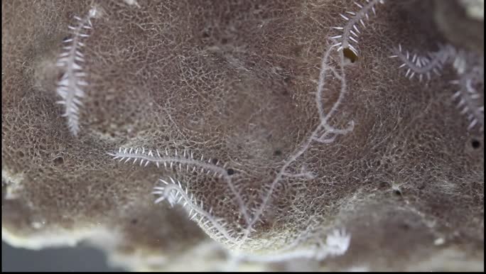
Habitat An endosymbiont of Petrosia sp. sponges (purple and white forms), in depth range from low water spring tide to at least 20 m. [details]
Type locality Channel Island, Darwin Harbour, Australia, about 200 m north of bridge, 12° 33.2' S, 130° 52.4' E (-12.553333° 130.873333°). [details]
