
File:MarshErosionMontSaintMichel.jpg
From MarineSpecies Introduced Traits Wiki
Revision as of 16:32, 11 October 2022 by Dronkers J (talk | contribs) (Marsh retreat in the southern part of the bay of Mont-Saint-Michel caused by an adjacent meandering tidal channel in the period 2019-2022 and marsh accretion in the north. The left triangle indicates the Mont-Saint-Michel and the right triangle the Poi...)
Size of this preview: 800 × 337 pixels. Other resolutions: 320 × 135 pixels | 1,518 × 639 pixels.
Original file (1,518 × 639 pixels, file size: 159 KB, MIME type: image/jpeg)
Summary
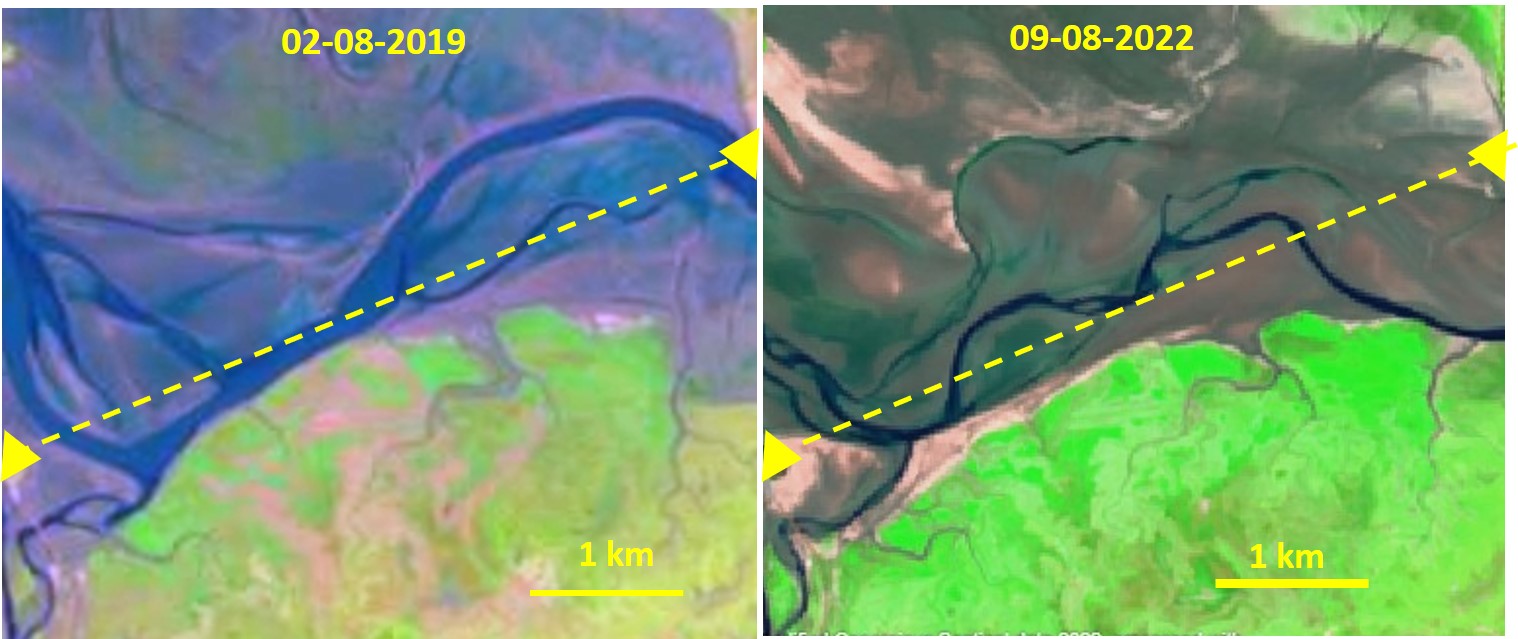
Marsh retreat in the southern part of the bay of Mont-Saint-Michel caused by an adjacent meandering tidal channel in the period 2019-2022 and marsh accretion in the north. The left triangle indicates the Mont-Saint-Michel and the right triangle the Pointe du Grouin; the dotted yellow line is drawn for reference. Tide channels are dark blue. Marsh vegetation is green. Sentinel satellite images.
File history
Click on a date/time to view the file as it appeared at that time.
| Date/Time | Thumbnail | Dimensions | User | Comment | |
|---|---|---|---|---|---|
| current | 16:32, 11 October 2022 | | 1,518 × 639 (159 KB) | Dronkers J (talk | contribs) | Marsh retreat in the southern part of the bay of Mont-Saint-Michel caused by an adjacent meandering tidal channel in the period 2019-2022 and marsh accretion in the north. The left triangle indicates the Mont-Saint-Michel and the right triangle the Poi... |
- You cannot overwrite this file.
File usage
The following page links to this file:
