
File list
This special page shows all uploaded files.
| Date | Name | Thumbnail | Size | User | Description | Versions |
|---|---|---|---|---|---|---|
| 21:38, 2 June 2024 | WaveOrbits.jpg (file) |  |
49 KB | Dronkers J | Particle displacements for deep and transitional waves. | 1 |
| 20:50, 2 June 2024 | DefSinusWave.jpg (file) |  |
25 KB | Dronkers J | Definition sketch for a sinusoidal wave. | 1 |
| 16:13, 23 May 2024 | CoveTGroinMorph.jpg (file) |  |
40 KB | Dronkers J | Equilibrium morphology of an artificial cove formed by T-groynes. | 1 |
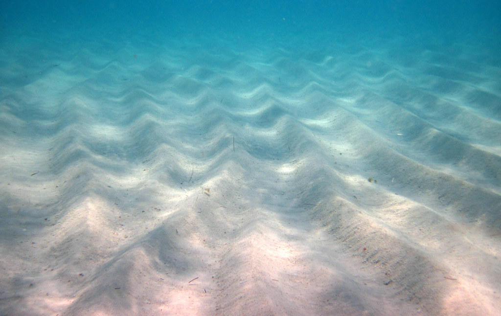
| 22:05, 16 May 2024 | SeabedRipplesBahamas.jpg (file) |  |
147 KB | Dronkers J | Symmetrical ripples in biogenic, aragonitic sand (shallow subtidal seafloor just offshore from Sand Dollar Beach, nw San Salvador Island, eastern Bahamas). Photo credit James St. John. Creative Commons Licence | 1 |
| 22:04, 16 May 2024 | RiverBedRipplesKennetcookRiver.jpg (file) |  |
288 KB | Dronkers J | Current-generated linguoid ripples, Kennetcook River, Nova Scotia, Canada. Photo credit J. Waldron https://sites.ualberta.ca/~jwaldron/ | 1 |
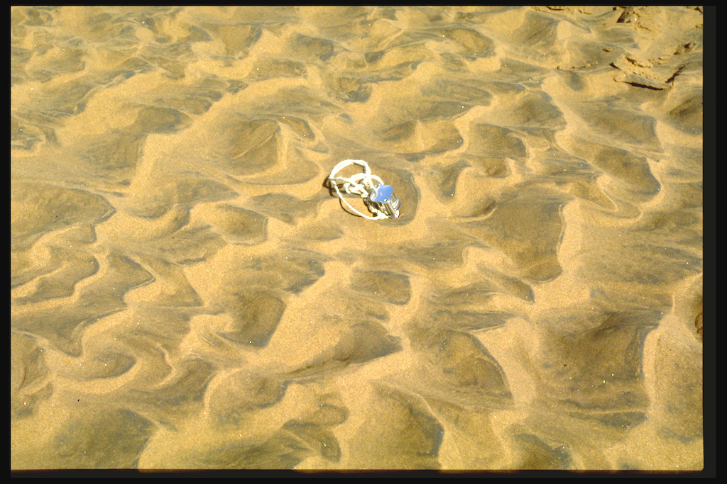
| 22:03, 16 May 2024 | CurrentRipplesMSM.jpg (file) |  |
103 KB | Dronkers J | Current ripples in a fine-sediment channel bed, Baie du Mont Saint Michel. | 1 |
| 22:02, 16 May 2024 | AntidunesWillametteRiver.jpg (file) |  |
139 KB | Dronkers J | Antidunes in the Willamette River (USA). Photo credit Marli Miller. https://geologypics.com/ | 1 |
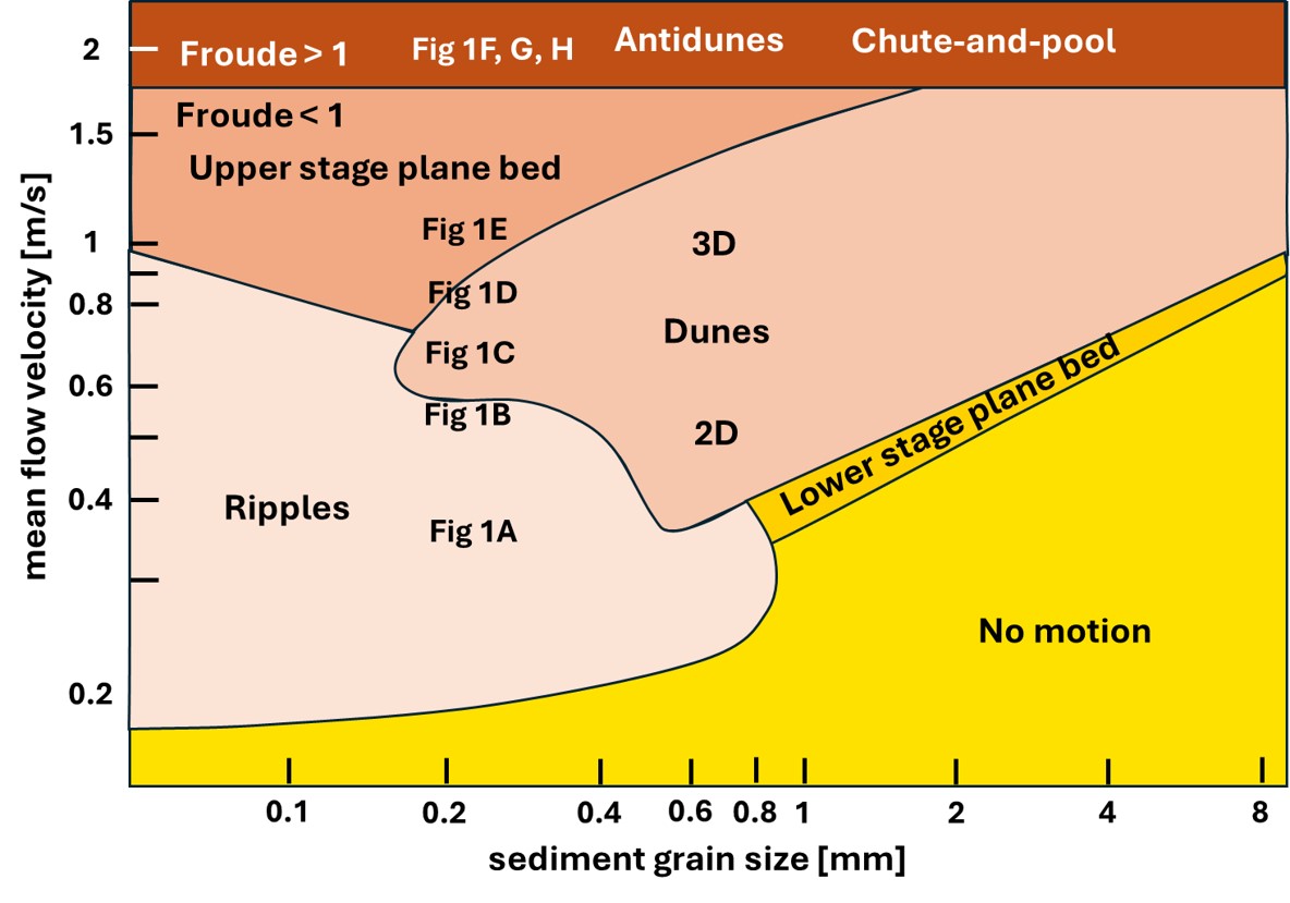
| 17:51, 16 May 2024 | BedformDiagram.jpg (file) |  |
122 KB | Dronkers J | Bedform stability diagram for unidirectional currents. Redrawn after Southard and Boguchwal (1990). | 1 |
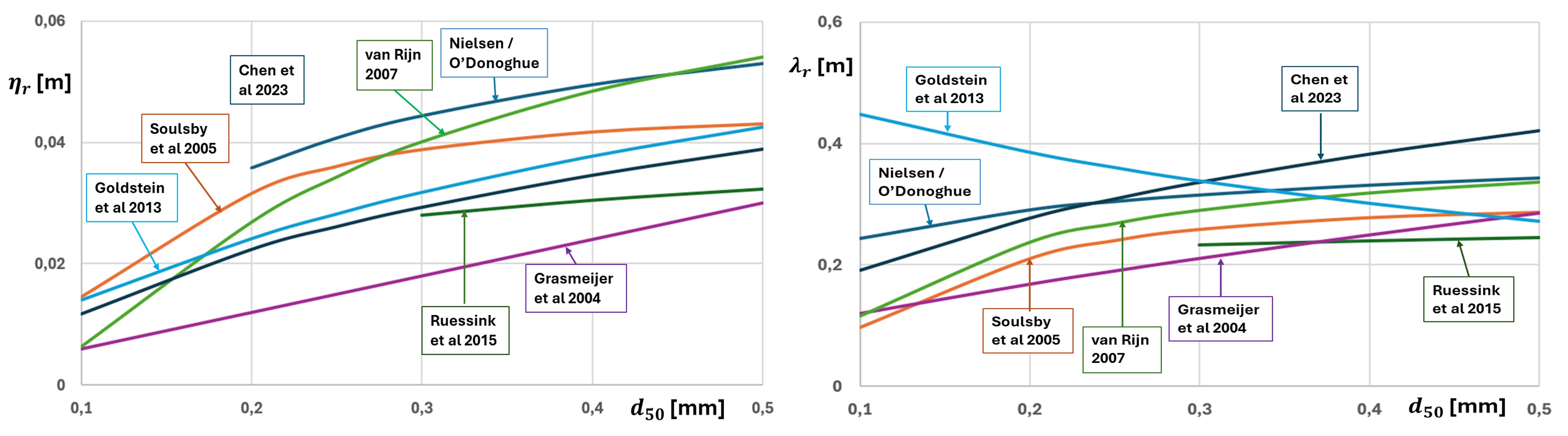
| 11:52, 16 May 2024 | RippleModels.jpg (file) |  |
423 KB | Dronkers J | Empirical ripple prediction formulas. Left: Predictions of the ripple height. Right: Predictions of the ripple wavelength. | 2 |
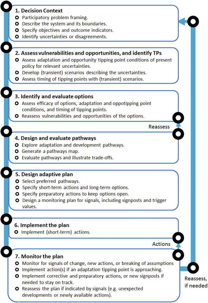
| 11:39, 10 May 2024 | DAPPScheme.jpg (file) |  |
81 KB | Dronkers J | Steps of the Dynamic Adaptation Policy Pathways approach. From Haasnoot et al. (2013) | 2 |
| 17:42, 4 May 2024 | MytilicultureSaintMichel.jpg (file) |  |
348 KB | Dronkers J | Mussel farm in Baie du Mont Saint Michel (France). Mussel cultivating takes place on poles (bouchots) drilled deep into the seabed. For seed collection, a coconut fiber rope is wrapped in a spiral around the post. When time comes for grow-out, a nettin... | 1 |
| 16:23, 28 April 2024 | DepositionFluxFlocs.jpg (file) |  |
74 KB | Dronkers J | Deposition flux of flocculated sediment from the San Francisco Bay tested in a flume. Modified from Mehta et al. (2014) | 2 |
| 10:14, 28 April 2024 | SettlingvelocityBarataria.jpg (file) |  |
34 KB | Dronkers J | Settling velocity as function of the velocity shear rate measured in Barataria basin (USA Gulf coast). Redrawn after McDonell et al. (2024). | 1 |
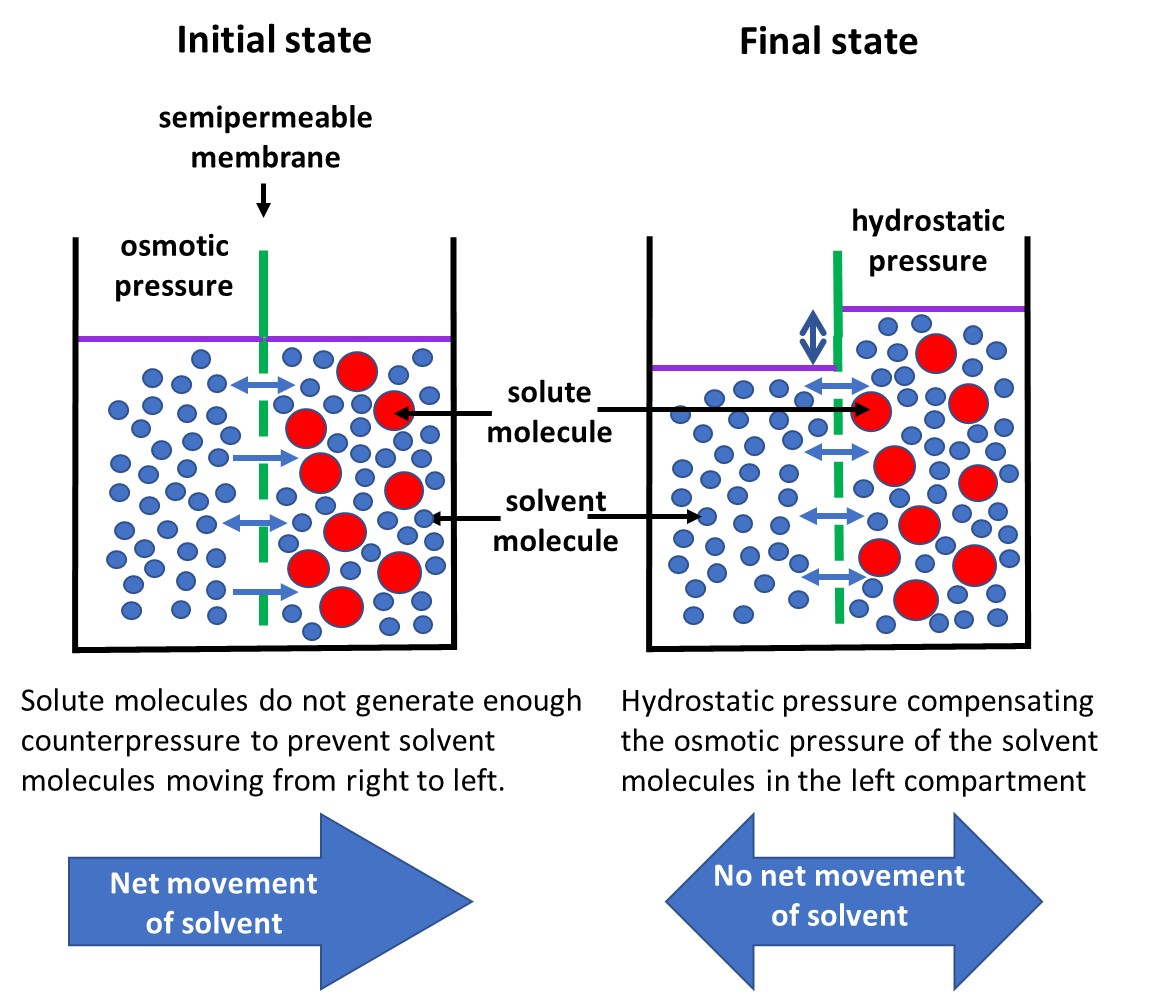
| 17:02, 27 April 2024 | OsmosisProcess.jpg (file) |  |
203 KB | Dronkers J | Osmosis through a semi-permeable membrane that allows passage of solvent molecules (blue) while blocking the passage of solute molecules (red). | 2 |
| 13:23, 22 April 2024 | Lysocline.jpg (file) |  |
53 KB | Dronkers J | Zones of calcite and aragonite dissolution. Redrawn after Harris et al. (2023). | 1 |
| 19:55, 15 April 2024 | RippleRegimeTransportCompressed.gif (file) | 1.9 MB | Dronkers J | Wave-induced sand transport over a seabed ripple. Courtesy Jebbe van der Werf. | 1 | |
| 17:59, 6 April 2024 | BeachClassification.jpg (file) |  |
51 KB | Dronkers J | Beach morphologies according to the parameters <math>\Omega</math> and <math>RTR</math>. Reflective beaches are found in the red zone and dissipative beaches in the blue zone. | 2 |
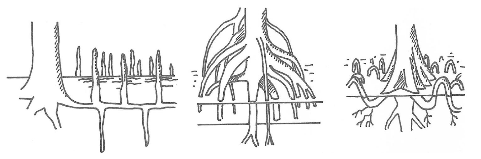
| 14:34, 4 April 2024 | MangroveRootSystems.jpg (file) |  |
82 KB | Dronkers J | Mangrove root systems. Avicennia, Rhizophora and Bruguiera, from left to right, after Marchand (2008) | 1 |
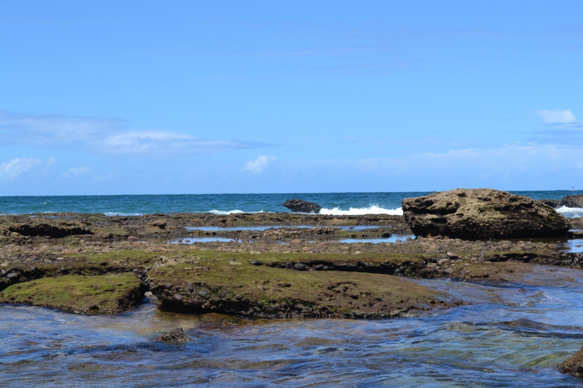
| 16:23, 1 April 2024 | BeachRockBrazil.jpg (file) |  |
194 KB | Dronkers J | Beachrock along the Brazilian coast. | 1 |
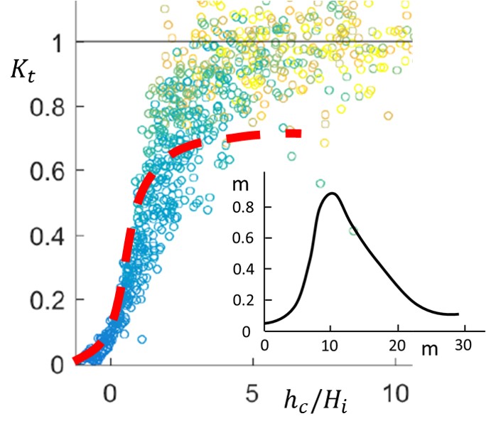
| 16:12, 31 March 2024 | WaveTransmissionEasternScheldtOysterReef.jpg (file) | 68 KB | Dronkers J | Comparison of Eq. (1) (red dashed line) with the wave transmission coefficient measured (blue/green/yellow dots)on an oyster reef in the Eastern Scheldt (Netherlands). Insert: Shape of the oyster reef. | 1 | |
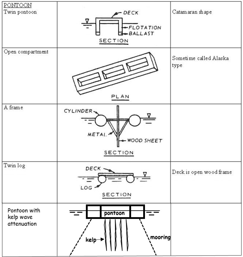
| 14:48, 30 March 2024 | PontoonBreakwaters.jpg (file) |  |
96 KB | Dronkers J | Different types of pontoon breakwaters. | 1 |
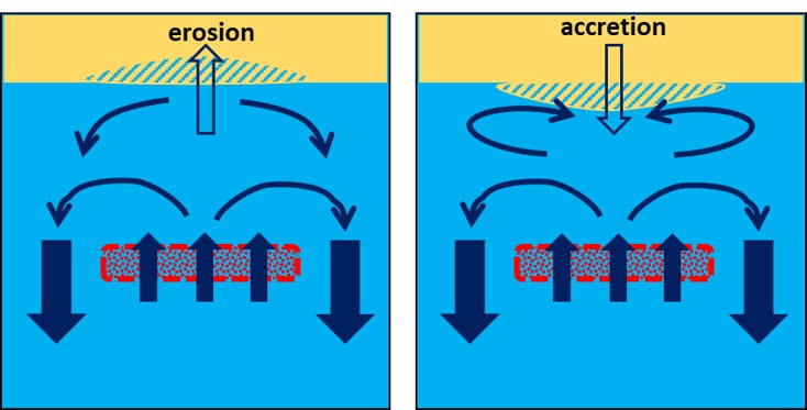
| 20:16, 28 March 2024 | SubmergedBreakwaterErosionSedimentation.jpg (file) |  |
54 KB | Dronkers J | Flow circulation patterns behind a submerged breakwater for shore-normal wave incidence. Beach erosion or beach accretion may occur depending on the type of circulation pattern. | 1 |
| 21:34, 26 March 2024 | ColumnRevetment.jpg (file) |  |
255 KB | Dronkers J | Column revetment of Marazion sea wall, Cornwall, United Kingdom. Credit: Charles Gould. Licensed under Creative Commons | 1 |
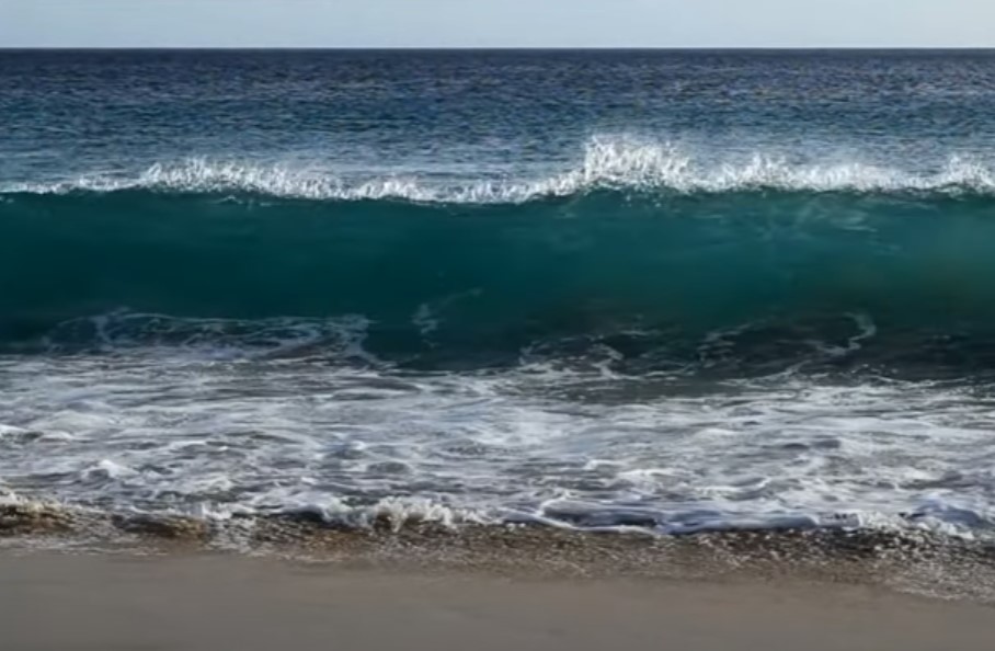
| 19:09, 27 February 2024 | WavePlungeLipari.jpg (file) |  |
175 KB | Dronkers J | Plunging wave, still from the video by Vincentz 2013 https://zenodo.org/records/8070591 under licence CC Y-SA (attribution and share-alike). | 1 |
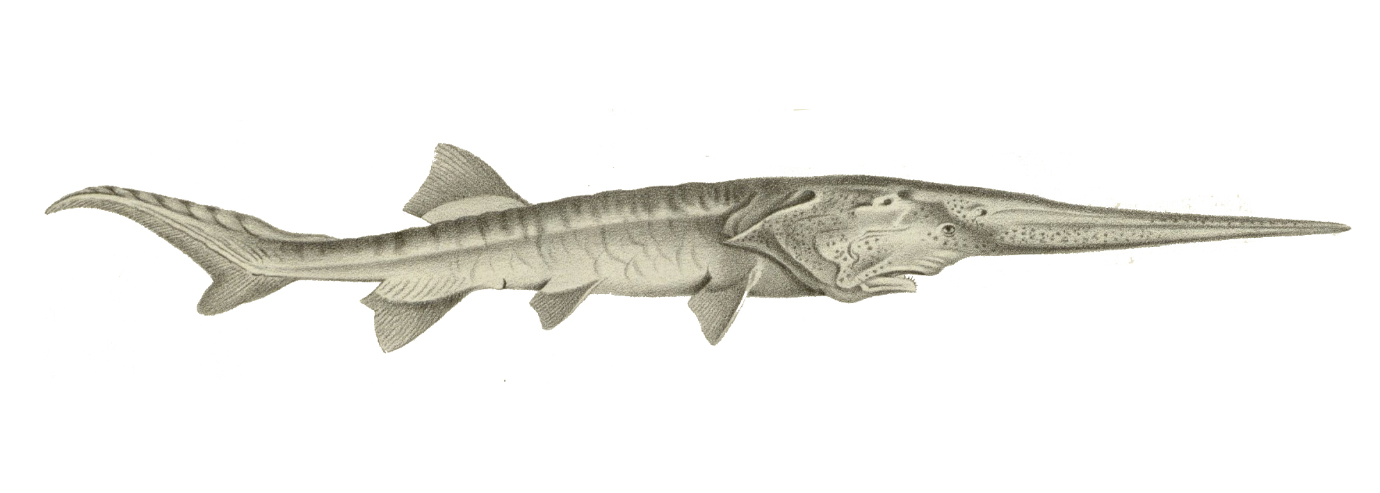
| 17:08, 23 February 2024 | PsephurusGladius.jpg (file) |  |
319 KB | Dronkers J | The Chinese paddlefish (''Psephurus gladius''). Image public domain. | 1 |
| 11:56, 23 February 2024 | WavePlunge.jpg (file) |  |
94 KB | Dronkers J | Plunging wave, still from the video by Vincentz 2013 https://zenodo.org/records/8070591 under licence CC Y-SA (attribution and share-alike). | 1 |
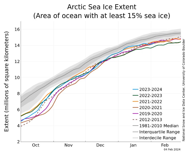
| 19:03, 22 February 2024 | ArcticIceCover.jpg (file) |  |
77 KB | Dronkers J | Arctic sea ice extent for several years between 2012 and 2024 compared to the average extent over the period 1981-2010. The gray areas around the median line show the interquartile and interdecile ranges of the data. Image credit National Snow and Ice... | 1 |
| 17:59, 16 February 2024 | Gabion-hengistbury-head.JPG (file) |  |
231 KB | Dronkers J | Picture of Gabions at hengistbury head. Taken by teacher (Mr. grice) and uploaded by en:User:Lmc169 |Source=Originally from [http://en.wikipedia.org en.wikipedia]; description page is/was [http://en.wikipedia.org/w/index.ph | 1 |
| 12:59, 16 February 2024 | CoastalErosionSophieDay.png (file) |  |
211 KB | Dronkers J | Coastal erosion, England. Photo credit Sophie Day. Creative Commons Licence. https://www.weforum.org/agenda/2022/10/coastal-erosion-environment-uk-climate/ | 1 |
| 15:43, 14 February 2024 | NorthSeaEmodnet.jpg (file) |  |
104 KB | Dronkers J | North Sea bathymetry. From [https://www.marineregions.org/gazetteer.php?p=image&pic=115811 EMODNET] Creative Commons licence | 1 |
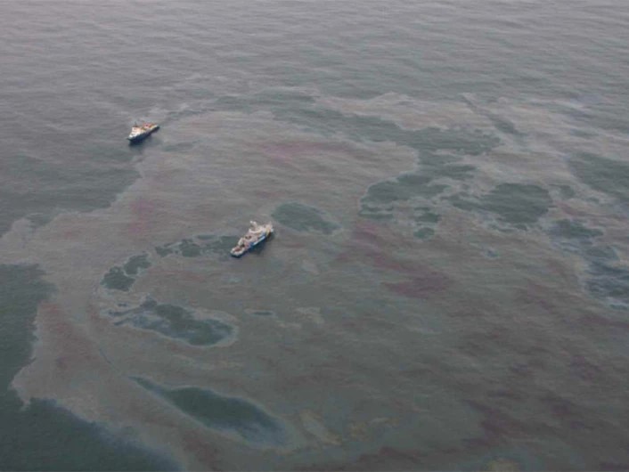
| 22:05, 8 February 2024 | OilSlick.jpg (file) |  |
53 KB | Dronkers J | Aerial image of an oil slick. Photo credit The Norwegian Coastal Administration/NOFO/Sundt Air. https://www.sciencenorway.no/environmental-protection-environmental-technology-forskningno/detecting-oil-spills-with-satellite/1460647 | 1 |
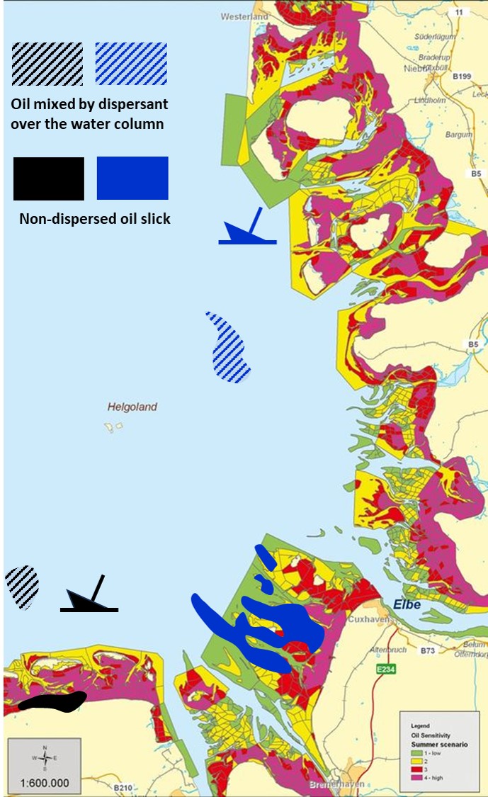
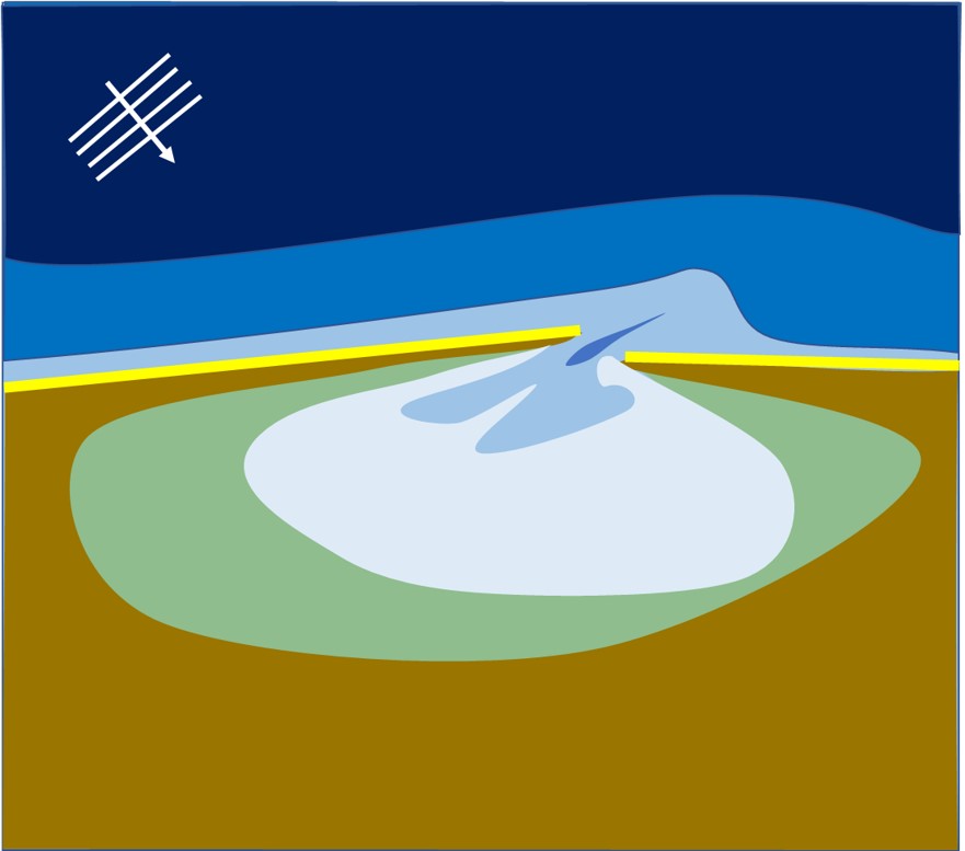
| 18:23, 6 February 2024 | WaddenOilSpill.jpg (file) |  |
185 KB | Dronkers J | Numerical simulation of oil spill locations 5 days after hypothetical oil releases on 15th of March 2008 at 04:00 UTC from a black oil tanker and a blue oil tanker. Dashed spills are mixed over the water column by dispersant application. Full black and... | 1 |
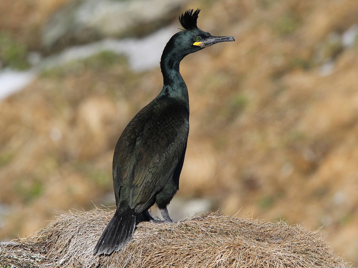
| 17:44, 4 February 2024 | EuropeanShagChristophMoning.jpg (file) |  |
250 KB | Dronkers J | European shag (''Gulosus aristotelis''). Photo credit Christoph Monin [https://ebird.org/science/status-and-trends ebird.org] | 1 |
| 17:27, 4 February 2024 | DeepwaterHorizonWikimedia.jpg (file) |  |
71 KB | Dronkers J | The Deepwater Horizon on fire. Photo Wikimedia. | 1 |
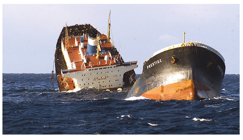
| 17:16, 4 February 2024 | PrestigeSinkingWikimedia.jpg (file) |  |
111 KB | Dronkers J | Sinking of the Prestige. Photo Wikimedia. | 1 |
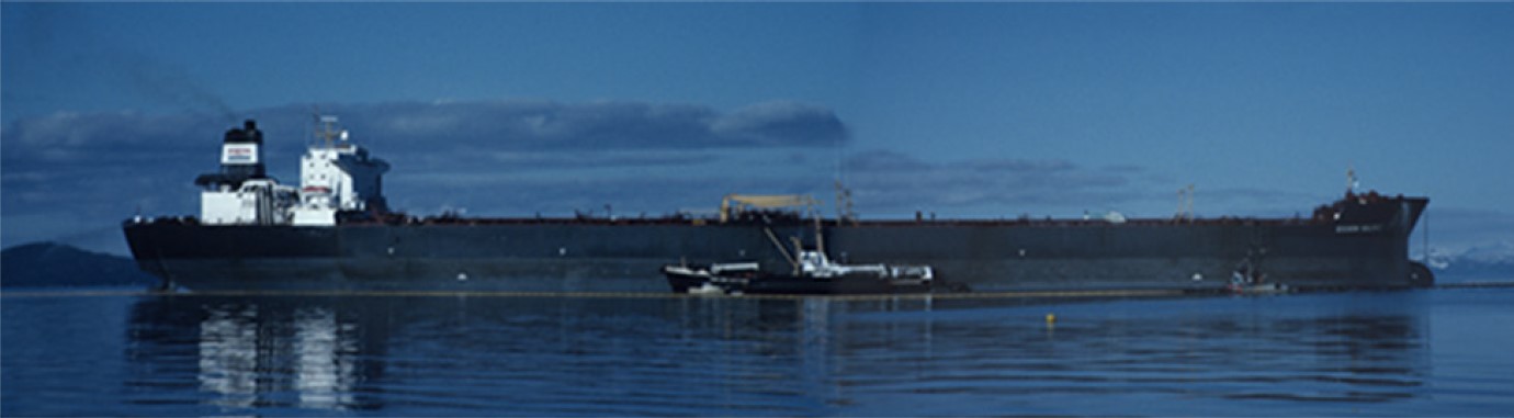
| 17:00, 4 February 2024 | ExxonValdezShigenaka.jpg (file) |  |
63 KB | Dronkers J | Exxon Valdez at Outside Bay, May 1989. Photo credit Gary Shigenaka, NOAA. | 1 |
| 19:47, 19 January 2024 | ConvergingEstuarySchematization.jpg (file) |  |
259 KB | Dronkers J | Schematization of a strongly converging estuary. (a) Plan view; (b) 3D view. | 2 |
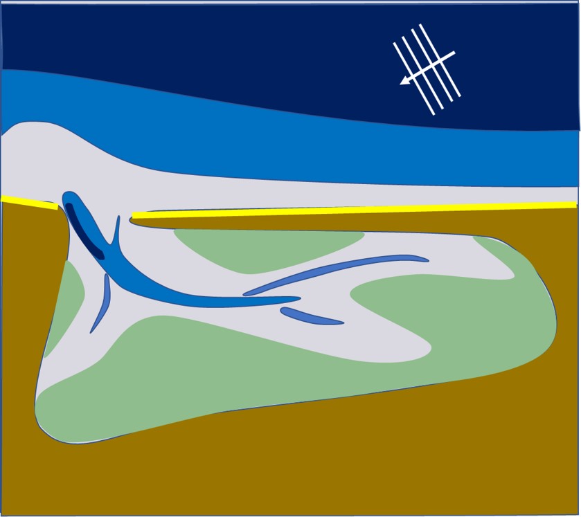
| 17:06, 15 January 2024 | WaveSpitLagoon.jpg (file) |  |
51 KB | Dronkers J | Schematic plan view of a wave-dominated estuary/lagoon semi-closed by a sand spit (highly oblique wave incidence). | 1 |
| 17:05, 15 January 2024 | WaveBarrierIslandLagoon.jpg (file) |  |
45 KB | Dronkers J | Schematic plan view of a wave-dominated estuary/lagoon with barrier island (close-to-normal wave incidence). | 1 |
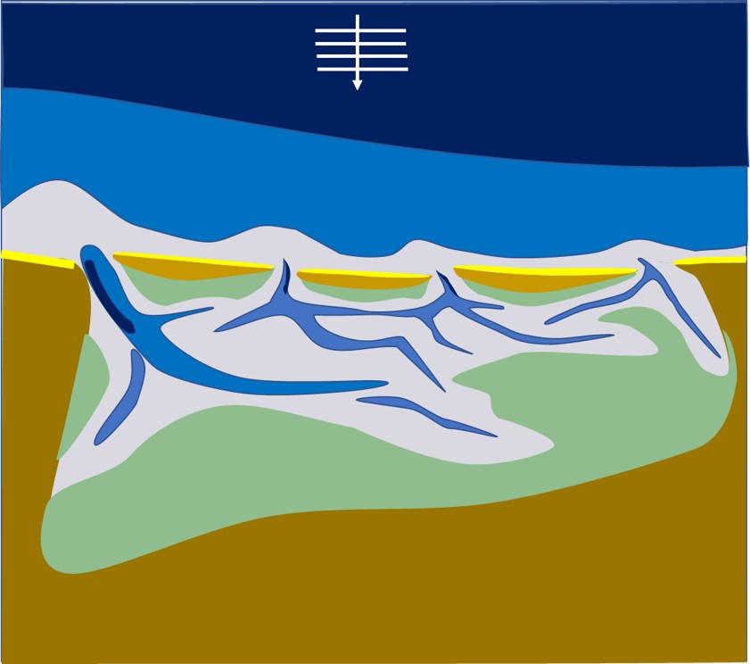
| 17:04, 15 January 2024 | WaveTideBarrierIslandsEstuary.jpg (file) |  |
62 KB | Dronkers J | Schematic plan view of a wave- and tide-dominated estuary with barrier islands (close-to-normal wave incidence). | 1 |
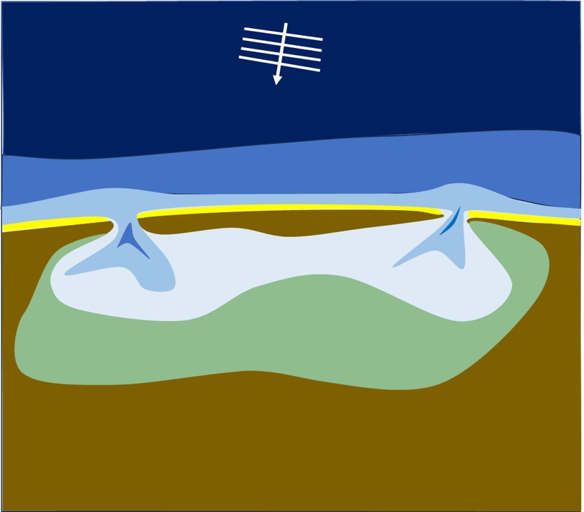
| 17:03, 15 January 2024 | WaveTideSpitEstuary.jpg (file) |  |
57 KB | Dronkers J | Schematic plan view of a wave- and tide-dominated estuary (highly oblique wave incidence). | 1 |
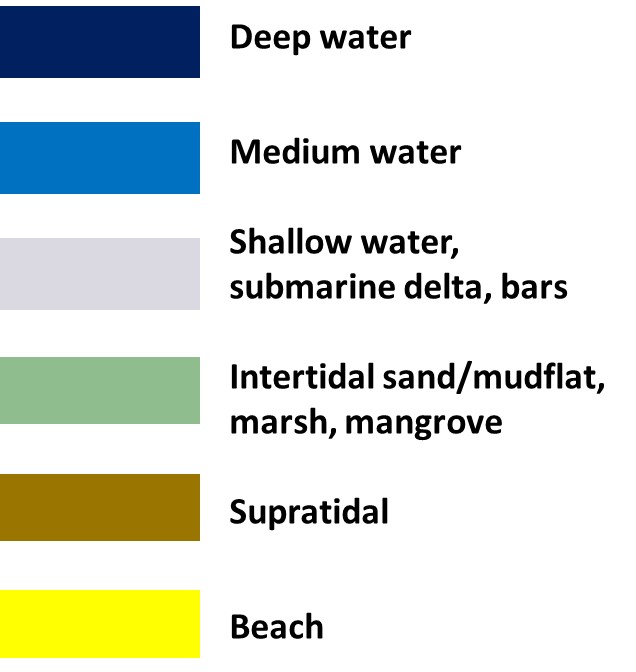
| 16:52, 15 January 2024 | EstuaryColors.jpg (file) |  |
46 KB | Dronkers J | Colors in estuary planviews | 2 |
| 18:22, 27 December 2023 | MgmtRealignWallaseaIsland.jpg (file) |  |
142 KB | Dronkers J | Salt marsh restoration Wallasea Island, UK, by managed realignment. Photo credit John Akerman. | 2 |
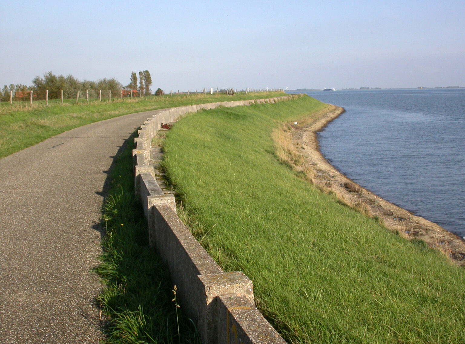
| 14:12, 27 December 2023 | GrassCoveredSeadike.jpg (file) |  |
418 KB | Dronkers J | Grass covered dike, Wolphaartsdijk - Veerse Meer, Zeeland, Netherlands (Image Bank Rijkswaterstaat, photo Jan van den Broeke). | 1 |
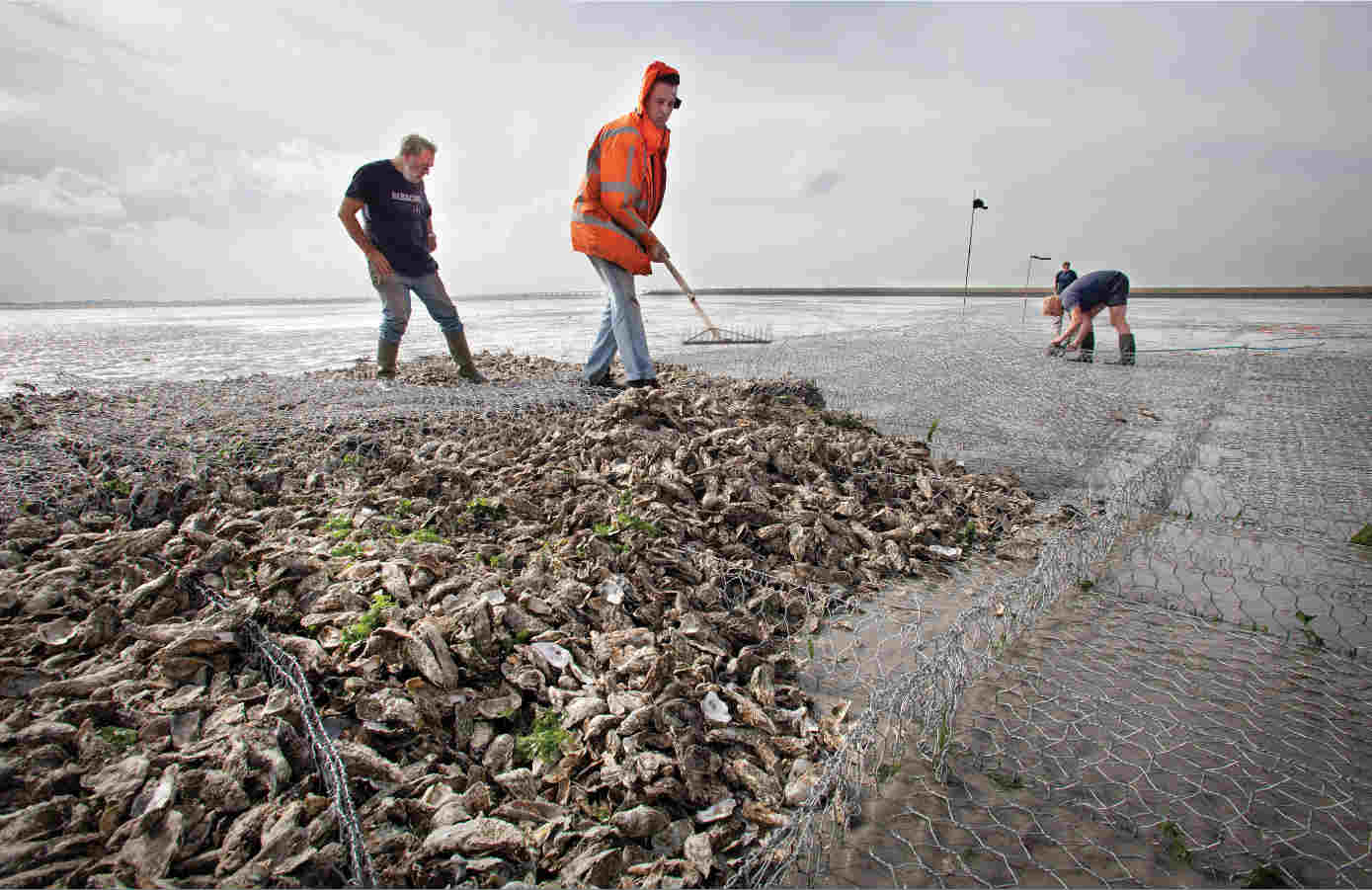
| 13:28, 27 December 2023 | OysterReefConstructionEcoshapeSmall.jpg (file) |  |
82 KB | Dronkers J | Development of an oyster reef in the Eastern Scheldt (Netherlands) for protection against tidal flat erosion. Photo credit Ecoshape Building with Nature https://www.ecoshape.org/en/ | 1 |
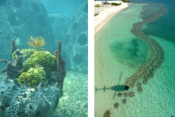
| 12:55, 27 December 2023 | ReefBallEcoshape.jpg (file) |  |
83 KB | Dronkers J | Left: Reef balls. Right: Reef ball breakwater. Image credit Ecoshape Building with nature. https://www.ecoshape.org/en/ | 1 |
| 11:54, 27 December 2023 | ReefBallBreakwater.jpg (file) |  |
28 KB | Dronkers J | Reef ball breakwater. Image credit Ecoshape Building with Nature https://www.ecoshape.org/en/ | 1 |
| 22:35, 25 December 2023 | NematodeCaenorhabditisElegans.jpg (file) |  |
50 KB | Dronkers J | Nematode ''Caenorhabditis elegans''. Photo credit Bob Goldstein, UNC Chapel Hill | 1 |
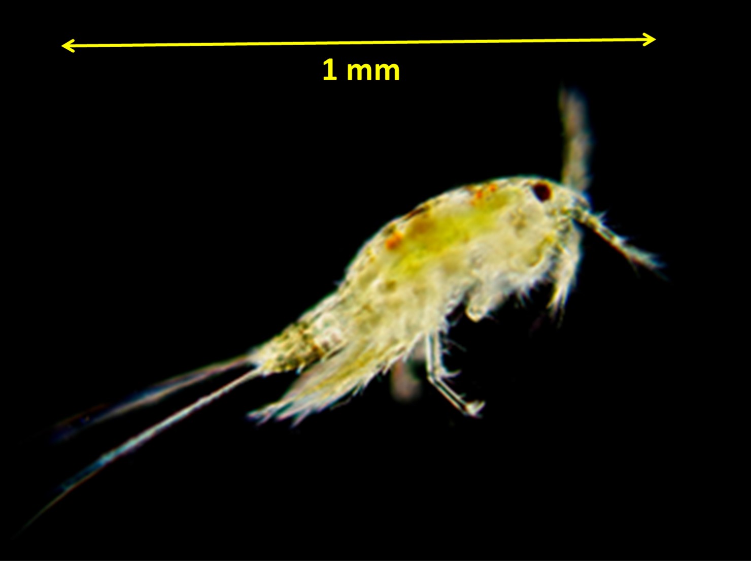
| 22:30, 25 December 2023 | HarpacticoidCopepod.jpg (file) |  |
79 KB | Dronkers J | Harpacticoid copepod. Photo credit Lodewijk van Walraven. | 1 |
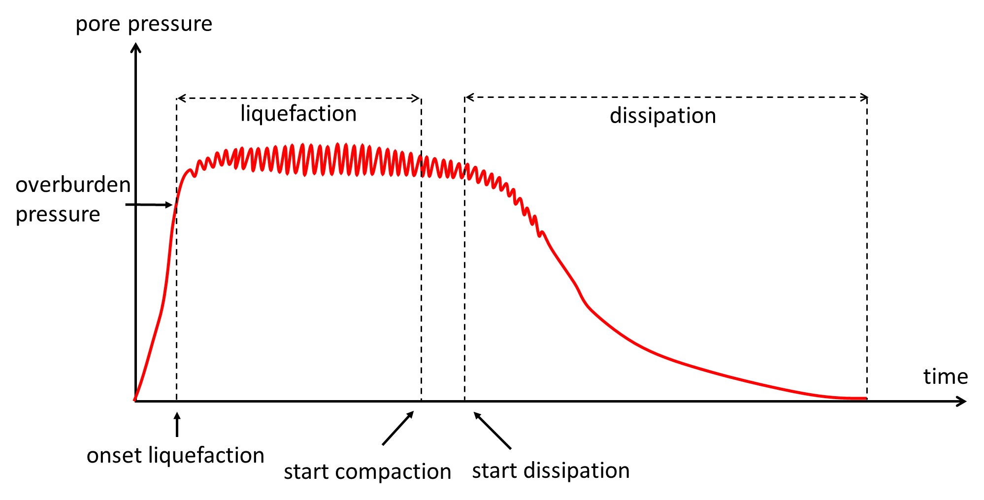
| 22:52, 13 December 2023 | PorePressureBuildUp.jpg (file) |  |
149 KB | Dronkers J | Time variation of pore water pressure at a certain depth. After Sui et al. 2020. | 2 |