Difference between revisions of "Template:This weeks featured article"
From MarineSpecies Introduced Traits Wiki
(→Tidal flats from space) |
|||
| (125 intermediate revisions by 4 users not shown) | |||
| Line 1: | Line 1: | ||
| − | = | + | <div style="float:right; margin-left:10px; margin-top:5px">[[File:Compendiumcoastandsea.jpg|160px|right|link=Compendium for Coast and Sea - creating a marine science-policy interface]]</div> |
| − | + | '''Compendium for Coast and Sea - creating a marine science-policy interface''' | |
| − | [[ | + | <p style="margin-top:-15px"><br/></p> |
| − | + | The Compendium for Coast and Sea is an integrated knowledge document about the socio-economic, environmental and institutional aspects of the coast and sea in Flanders and Belgium. As such, it constitutes a one-stop shop for data and information from the Flemish and Belgian marine and maritime research community and experts. The Compendium for Coast and Sea is an initiative of the Flanders Marine Institute (VLIZ) and was developed in close collaboration with experts from the research community, government, industry and civil society organisations. The first version of the Compendium was launched in 2013, a second edition was presented in 2015. | |
| − | + | </div> | |
| − | The | ||
Latest revision as of 15:52, 8 April 2016
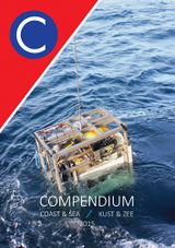
Compendium for Coast and Sea - creating a marine science-policy interface
The Compendium for Coast and Sea is an integrated knowledge document about the socio-economic, environmental and institutional aspects of the coast and sea in Flanders and Belgium. As such, it constitutes a one-stop shop for data and information from the Flemish and Belgian marine and maritime research community and experts. The Compendium for Coast and Sea is an initiative of the Flanders Marine Institute (VLIZ) and was developed in close collaboration with experts from the research community, government, industry and civil society organisations. The first version of the Compendium was launched in 2013, a second edition was presented in 2015.

