
File list
This special page shows all uploaded files.
| Date | Name | Thumbnail | Size | Description | Versions |
|---|---|---|---|---|---|
| 16:23, 28 April 2024 | DepositionFluxFlocs.jpg (file) |  |
74 KB | Deposition flux of flocculated sediment from the San Francisco Bay tested in a flume. Modified from Mehta et al. (2014) | 2 |
| 10:14, 28 April 2024 | SettlingvelocityBarataria.jpg (file) |  |
34 KB | Settling velocity as function of the velocity shear rate measured in Barataria basin (USA Gulf coast). Redrawn after McDonell et al. (2024). | 1 |
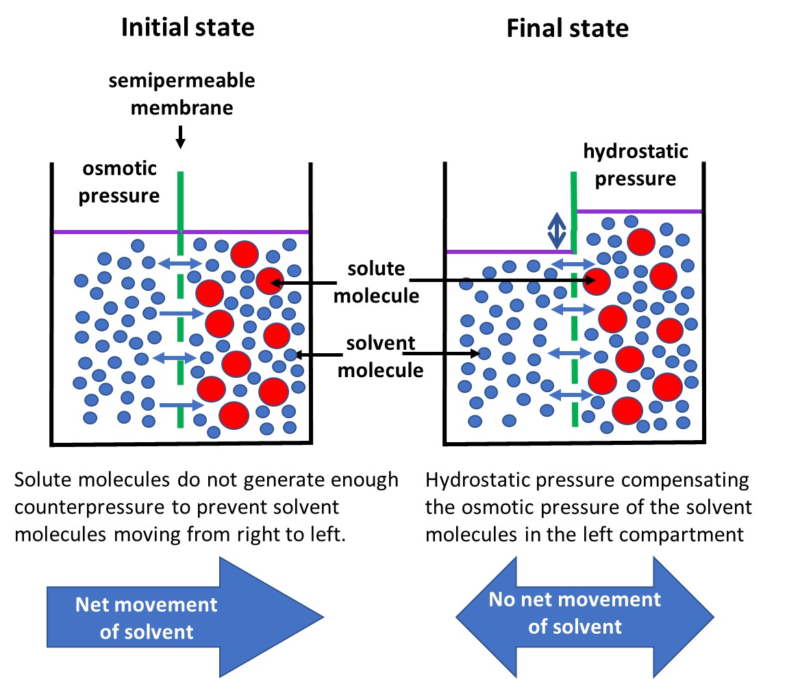
| 17:02, 27 April 2024 | OsmosisProcess.jpg (file) |  |
203 KB | Osmosis through a semi-permeable membrane that allows passage of solvent molecules (blue) while blocking the passage of solute molecules (red). | 2 |
| 13:23, 22 April 2024 | Lysocline.jpg (file) |  |
53 KB | Zones of calcite and aragonite dissolution. Redrawn after Harris et al. (2023). | 1 |
| 19:55, 15 April 2024 | RippleRegimeTransportCompressed.gif (file) | 1.9 MB | Wave-induced sand transport over a seabed ripple. Courtesy Jebbe van der Werf. | 1 | |
| 17:59, 6 April 2024 | BeachClassification.jpg (file) |  |
51 KB | Beach morphologies according to the parameters <math>\Omega</math> and <math>RTR</math>. Reflective beaches are found in the red zone and dissipative beaches in the blue zone. | 2 |
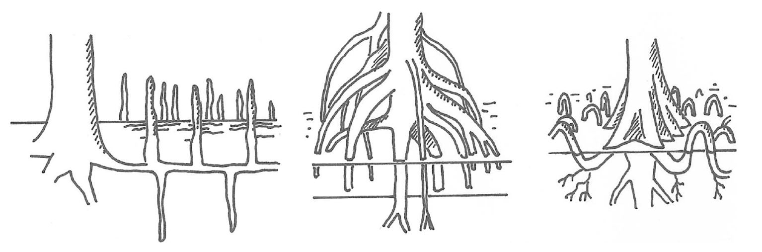
| 14:34, 4 April 2024 | MangroveRootSystems.jpg (file) |  |
82 KB | Mangrove root systems. Avicennia, Rhizophora and Bruguiera, from left to right, after Marchand (2008) | 1 |
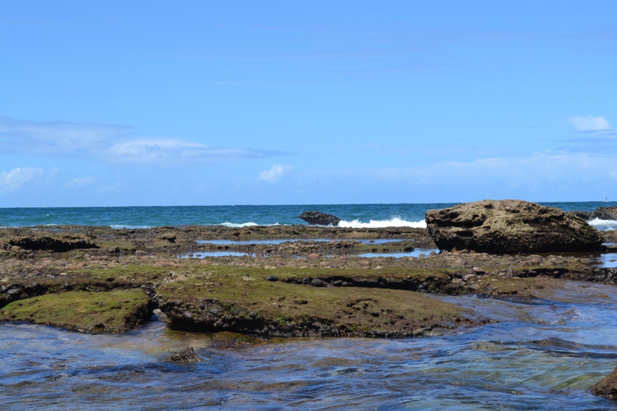
| 16:23, 1 April 2024 | BeachRockBrazil.jpg (file) |  |
194 KB | Beachrock along the Brazilian coast. | 1 |
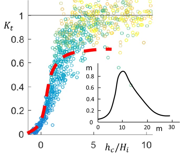
| 16:12, 31 March 2024 | WaveTransmissionEasternScheldtOysterReef.jpg (file) | 68 KB | Comparison of Eq. (1) (red dashed line) with the wave transmission coefficient measured (blue/green/yellow dots)on an oyster reef in the Eastern Scheldt (Netherlands). Insert: Shape of the oyster reef. | 1 | |
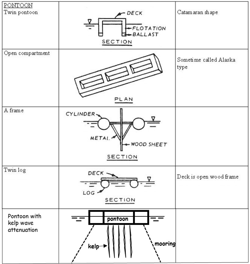
| 14:48, 30 March 2024 | PontoonBreakwaters.jpg (file) |  |
96 KB | Different types of pontoon breakwaters. | 1 |
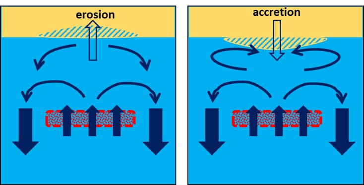
| 20:16, 28 March 2024 | SubmergedBreakwaterErosionSedimentation.jpg (file) |  |
54 KB | Flow circulation patterns behind a submerged breakwater for shore-normal wave incidence. Beach erosion or beach accretion may occur depending on the type of circulation pattern. | 1 |
| 21:34, 26 March 2024 | ColumnRevetment.jpg (file) |  |
255 KB | Column revetment of Marazion sea wall, Cornwall, United Kingdom. Credit: Charles Gould. Licensed under Creative Commons | 1 |
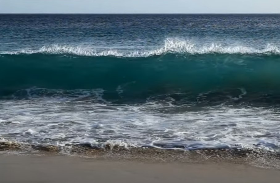
| 19:09, 27 February 2024 | WavePlungeLipari.jpg (file) |  |
175 KB | Plunging wave, still from the video by Vincentz 2013 https://zenodo.org/records/8070591 under licence CC Y-SA (attribution and share-alike). | 1 |
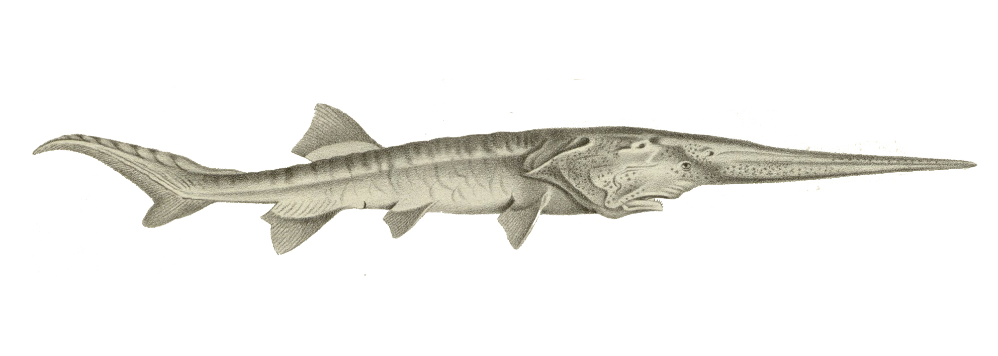
| 17:08, 23 February 2024 | PsephurusGladius.jpg (file) |  |
319 KB | The Chinese paddlefish (''Psephurus gladius''). Image public domain. | 1 |
| 11:56, 23 February 2024 | WavePlunge.jpg (file) |  |
94 KB | Plunging wave, still from the video by Vincentz 2013 https://zenodo.org/records/8070591 under licence CC Y-SA (attribution and share-alike). | 1 |
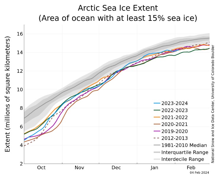
| 19:03, 22 February 2024 | ArcticIceCover.jpg (file) |  |
77 KB | Arctic sea ice extent for several years between 2012 and 2024 compared to the average extent over the period 1981-2010. The gray areas around the median line show the interquartile and interdecile ranges of the data. Image credit National Snow and Ice... | 1 |
| 17:59, 16 February 2024 | Gabion-hengistbury-head.JPG (file) |  |
231 KB | Picture of Gabions at hengistbury head. Taken by teacher (Mr. grice) and uploaded by en:User:Lmc169 |Source=Originally from [http://en.wikipedia.org en.wikipedia]; description page is/was [http://en.wikipedia.org/w/index.ph | 1 |
| 12:59, 16 February 2024 | CoastalErosionSophieDay.png (file) |  |
211 KB | Coastal erosion, England. Photo credit Sophie Day. Creative Commons Licence. https://www.weforum.org/agenda/2022/10/coastal-erosion-environment-uk-climate/ | 1 |
| 15:43, 14 February 2024 | NorthSeaEmodnet.jpg (file) |  |
104 KB | North Sea bathymetry. From [https://www.marineregions.org/gazetteer.php?p=image&pic=115811 EMODNET] Creative Commons licence | 1 |
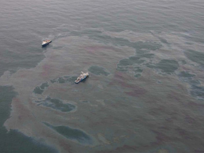
| 22:05, 8 February 2024 | OilSlick.jpg (file) |  |
53 KB | Aerial image of an oil slick. Photo credit The Norwegian Coastal Administration/NOFO/Sundt Air. https://www.sciencenorway.no/environmental-protection-environmental-technology-forskningno/detecting-oil-spills-with-satellite/1460647 | 1 |
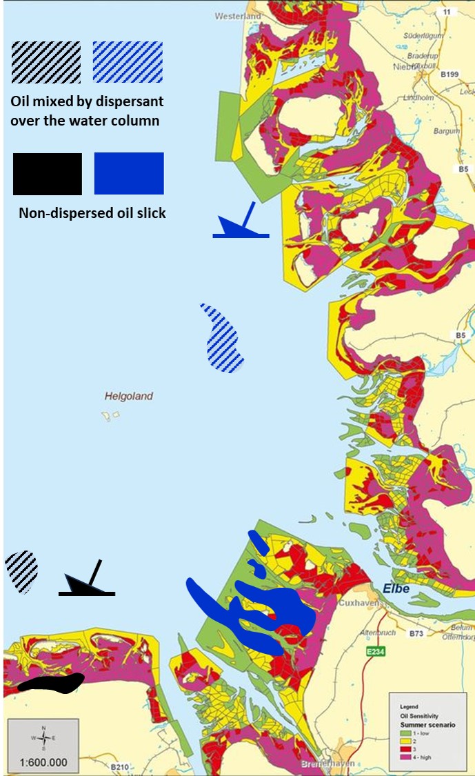
| 18:23, 6 February 2024 | WaddenOilSpill.jpg (file) |  |
185 KB | Numerical simulation of oil spill locations 5 days after hypothetical oil releases on 15th of March 2008 at 04:00 UTC from a black oil tanker and a blue oil tanker. Dashed spills are mixed over the water column by dispersant application. Full black and... | 1 |
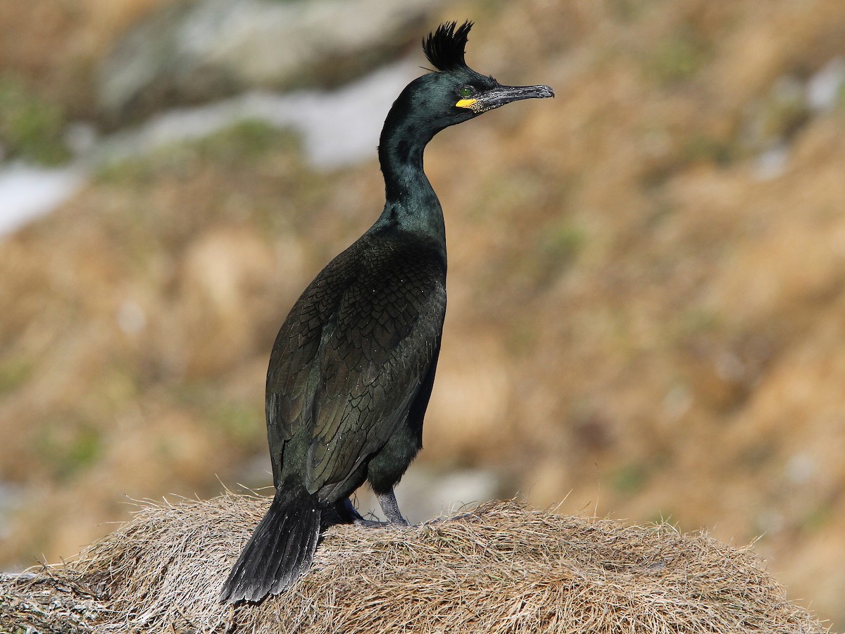
| 17:44, 4 February 2024 | EuropeanShagChristophMoning.jpg (file) |  |
250 KB | European shag (''Gulosus aristotelis''). Photo credit Christoph Monin [https://ebird.org/science/status-and-trends ebird.org] | 1 |
| 17:27, 4 February 2024 | DeepwaterHorizonWikimedia.jpg (file) |  |
71 KB | The Deepwater Horizon on fire. Photo Wikimedia. | 1 |
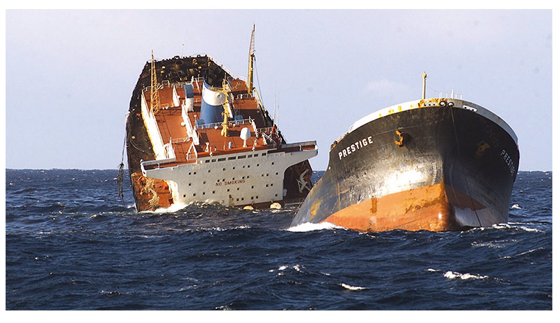
| 17:16, 4 February 2024 | PrestigeSinkingWikimedia.jpg (file) |  |
111 KB | Sinking of the Prestige. Photo Wikimedia. | 1 |
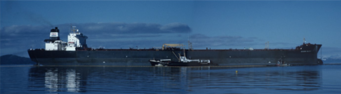
| 17:00, 4 February 2024 | ExxonValdezShigenaka.jpg (file) |  |
63 KB | Exxon Valdez at Outside Bay, May 1989. Photo credit Gary Shigenaka, NOAA. | 1 |
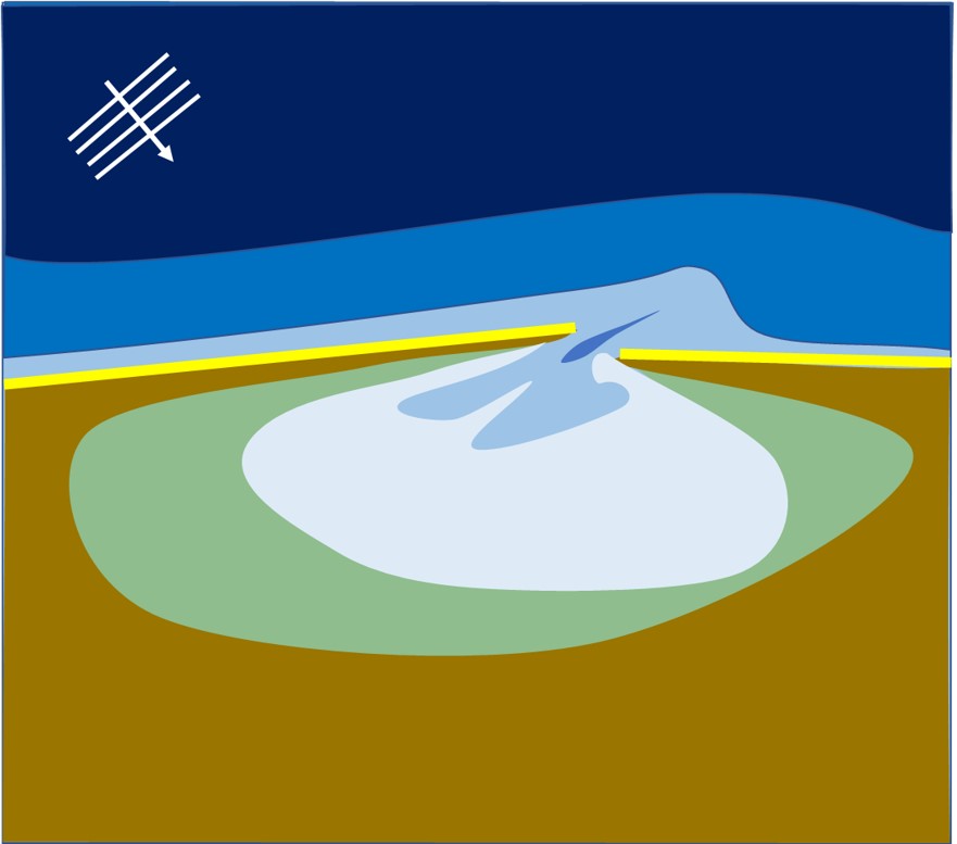
| 19:47, 19 January 2024 | ConvergingEstuarySchematization.jpg (file) |  |
259 KB | Schematization of a strongly converging estuary. (a) Plan view; (b) 3D view. | 2 |
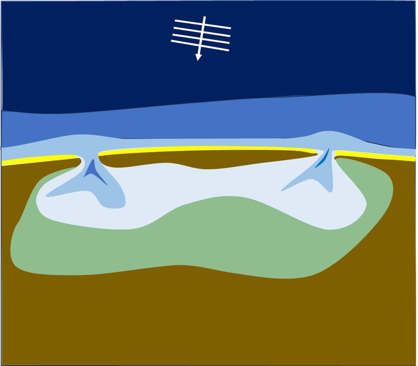
| 17:06, 15 January 2024 | WaveSpitLagoon.jpg (file) |  |
51 KB | Schematic plan view of a wave-dominated estuary/lagoon semi-closed by a sand spit (highly oblique wave incidence). | 1 |
| 17:05, 15 January 2024 | WaveBarrierIslandLagoon.jpg (file) |  |
45 KB | Schematic plan view of a wave-dominated estuary/lagoon with barrier island (close-to-normal wave incidence). | 1 |
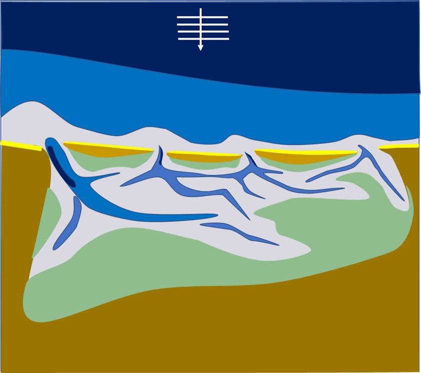
| 17:04, 15 January 2024 | WaveTideBarrierIslandsEstuary.jpg (file) |  |
62 KB | Schematic plan view of a wave- and tide-dominated estuary with barrier islands (close-to-normal wave incidence). | 1 |
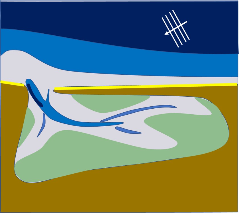
| 17:03, 15 January 2024 | WaveTideSpitEstuary.jpg (file) |  |
57 KB | Schematic plan view of a wave- and tide-dominated estuary (highly oblique wave incidence). | 1 |
| 16:52, 15 January 2024 | EstuaryColors.jpg (file) |  |
46 KB | Colors in estuary planviews | 2 |
| 18:22, 27 December 2023 | MgmtRealignWallaseaIsland.jpg (file) |  |
142 KB | Salt marsh restoration Wallasea Island, UK, by managed realignment. Photo credit John Akerman. | 2 |
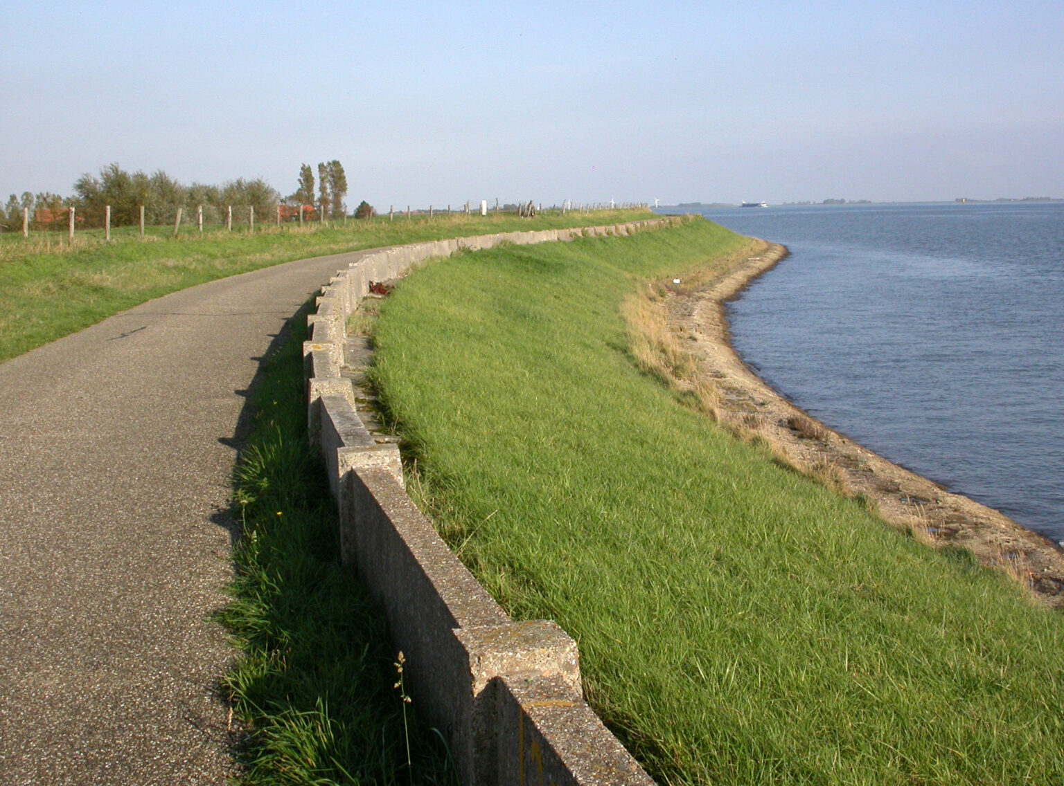
| 14:12, 27 December 2023 | GrassCoveredSeadike.jpg (file) |  |
418 KB | Grass covered dike, Wolphaartsdijk - Veerse Meer, Zeeland, Netherlands (Image Bank Rijkswaterstaat, photo Jan van den Broeke). | 1 |
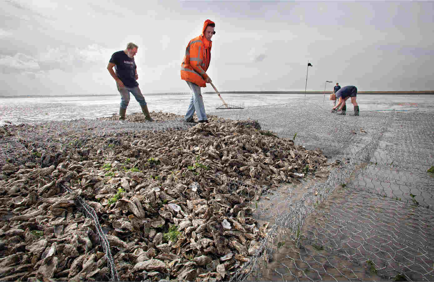
| 13:28, 27 December 2023 | OysterReefConstructionEcoshapeSmall.jpg (file) |  |
82 KB | Development of an oyster reef in the Eastern Scheldt (Netherlands) for protection against tidal flat erosion. Photo credit Ecoshape Building with Nature https://www.ecoshape.org/en/ | 1 |
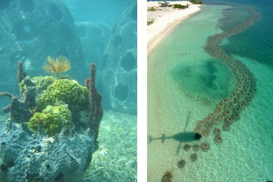
| 12:55, 27 December 2023 | ReefBallEcoshape.jpg (file) |  |
83 KB | Left: Reef balls. Right: Reef ball breakwater. Image credit Ecoshape Building with nature. https://www.ecoshape.org/en/ | 1 |
| 11:54, 27 December 2023 | ReefBallBreakwater.jpg (file) |  |
28 KB | Reef ball breakwater. Image credit Ecoshape Building with Nature https://www.ecoshape.org/en/ | 1 |
| 22:35, 25 December 2023 | NematodeCaenorhabditisElegans.jpg (file) |  |
50 KB | Nematode ''Caenorhabditis elegans''. Photo credit Bob Goldstein, UNC Chapel Hill | 1 |
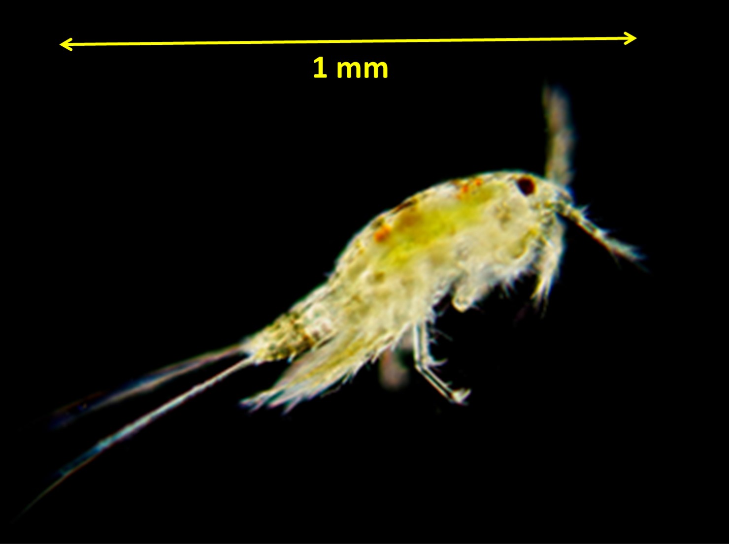
| 22:30, 25 December 2023 | HarpacticoidCopepod.jpg (file) |  |
79 KB | Harpacticoid copepod. Photo credit Lodewijk van Walraven. | 1 |
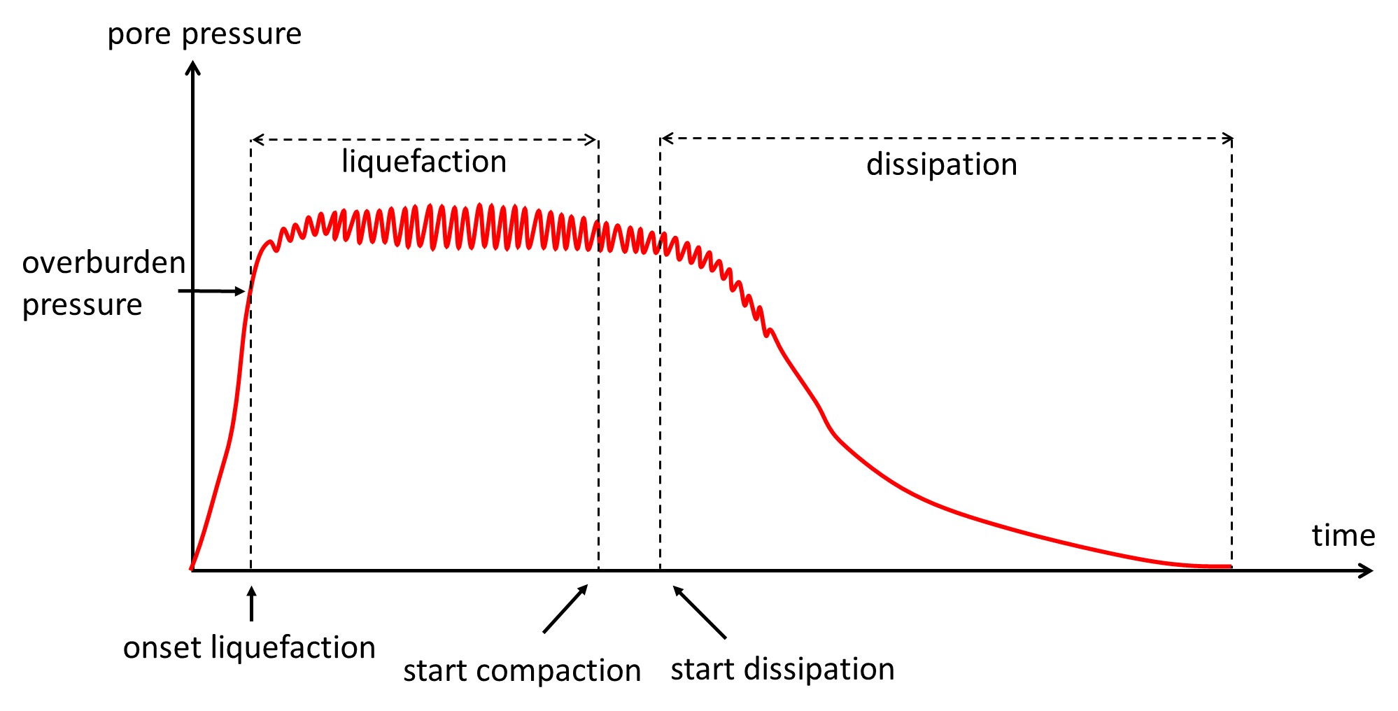
| 22:52, 13 December 2023 | PorePressureBuildUp.jpg (file) |  |
149 KB | Time variation of pore water pressure at a certain depth. After Sui et al. 2020. | 2 |
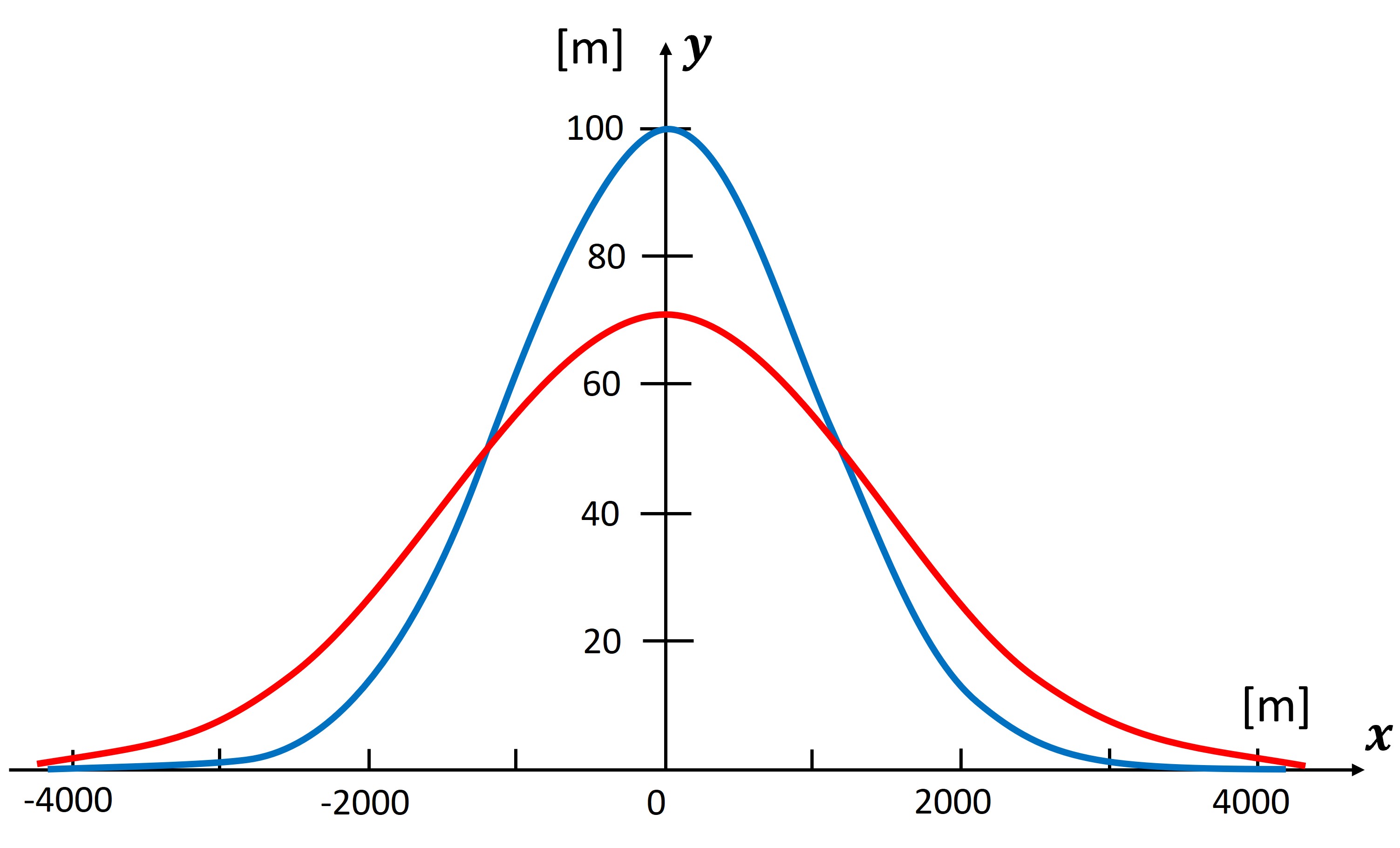
| 18:44, 21 November 2023 | NourishmentLongshore.jpg (file) |  |
246 KB | Evolution Gaussian-shape nourishment (a = 100 m, \sigma_0 = 1000 m) with littoral drift (<math>Q_0 = 4 \, 10^5 m^3/yr)</math> and berm height + closure depth <math>D = 8 m</math>. Blue curve: <math>t=0</math>, red curve <math>t=10 year</math>. No cross... | 1 |
| 23:11, 17 November 2023 | WaveAngles.jpg (file) |  |
70 KB | Wave incidence angles in a 1-line model where the breaker line is parallel to the shoreline. | 1 |
| 20:37, 16 October 2023 | DistributionNonLinearWaves.jpg (file) |  |
54 KB | The probability density distributions Eq. (C3) for <math>S=0</math> (blue) and <math>S=0.3</math> (red). | 1 |
| 20:36, 16 October 2023 | AiryFunction.jpg (file) |  |
41 KB | The Airy function. | 1 |
| 20:28, 13 September 2023 | DuneFootRecovery.jpg (file) |  |
513 KB | Examples of dune-foot retreat and recovery. 7a. Variation of the dune-foot position in a beach transect of the island Walcheren (Netherlands) over the period 1900-2010 (solid white line, based on annual surveys of Rijkswaterstaat <ref>Jeuken, C., Ruess... | 1 |
| 11:09, 20 August 2023 | WorldProdFisheryAquacultureFAO2020.jpg (file) |  |
73 KB | Global trends in different types of fisheries, showing the fast increase of aquaculture. In 2020 the total aquaculture production (algae mariculture excluded) exceeded the production of capture (wild) fisheries. The production of inland aquaculture was... | 1 |
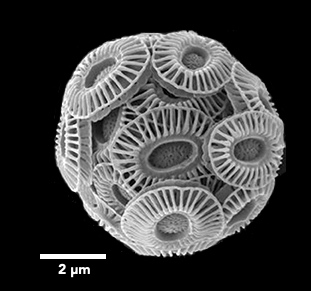
| 16:13, 10 August 2023 | EmilianiaHuxleyi.jpg (file) |  |
33 KB | ''Emiliania huxleyi'' | 1 |
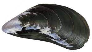
| 17:28, 7 August 2023 | Mytilus Edulis.jpg (file) |  |
6 KB | ''Mytilus edulis'' | 1 |
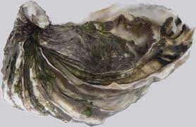
| 17:26, 7 August 2023 | MagallanaGigas.jpg (file) |  |
8 KB | ''Magallana gigas'' | 1 |
| 17:25, 7 August 2023 | AbraAlba.jpg (file) |  |
3 KB | ''Abra alba'' | 1 |
| 17:25, 7 August 2023 | ArgopectenPurpuratus.jpg (file) |  |
7 KB | ''Argopecten purpuratus'' | 1 |